By Wang Yinxin, Yao Xueqing, People's Daily
Ecological research is a task that investigates, monitors and evaluates various types of ecosystems and biological species. It is a key measure to get a clear picture of the ecology, understand its variation, and evaluate the weaknesses and achievements in ecological conservation.
Over the recent years, local authorities across China have made constant efforts to carry out ecological research and innovate investigation methods. The outcomes are widely applied in resource census, policy-making and science popularization, which forcefully drives the progress of ecological conservation.
East China's Jiangsu province has established a multi-dimensional technical system that integrates water, land and air monitoring methods for water ecological surveys.
The system employs satellite remote sensing, unmanned aerial vehicles (UAVs) and ground monitoring facilities to acquire ecological data for evaluation. Such ecological research is launched multiple times a year covering the province's major rivers, lakes and sea waters.
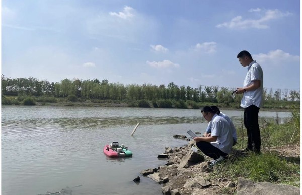
During a recent investigation, a UAV was employed by ecological investigators from the environment monitoring center of the Department of Ecology and Environment of Jiangsu province to build a 3D model of a section of the Yangtze River bank. Another one was sent to take water samples at designated locations in the river.
At the same time, a multispectral UAV was launched to examine the vegetation along the banks of the Yangtze River.
"Natural banks play a very important role in water ecology," said Zhang Yue, an ecological investigator at the environment monitoring center.
Based on data obtained by the multispectral UAV, over 80 percent of the area along the investigated section of the river was covered by vegetation, which indicated sound ecological recovery.
"By inputting over 6,000 photos taken by the 3D-modeling UAV into a software, a 3D model of the investigated section will be built, and then we will work to check and improve the model," said Zhang.
She told People's Daily that every model can be compared vertically, which can even tell how many trees are newly planted in parks.
As regards the water samples taken during the investigation, some were used for water quality tests, and the rest for environmental DNA sequencing, a type of analysis that provides clues about the bio-species in the water.
Information technology has significantly facilitated ecological research across China. According to statistics released by the China's National Forestry and Grassland Administration, in 2021, China dispatched about 17,000 personnel to 31 provinces and autonomous regions so as to finish monitoring 457,000 sample areas and about 470 million remote detection spots.
In that year, the administration for the first time had realized full coverage of forest, grassland and wetland monitoring in the country.
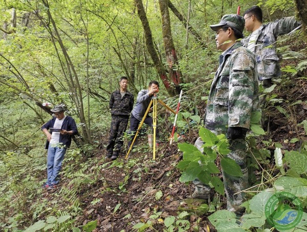
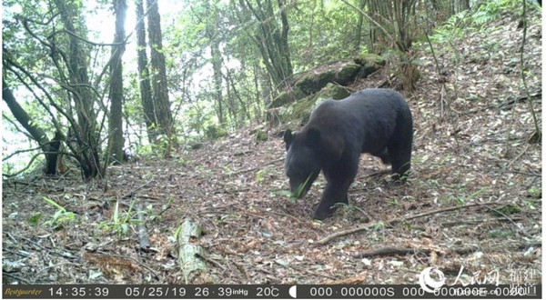
The Longqi Mountain National Nature Reserve in southeast China's Fujian province has launched constant biodiversity monitoring programs with infrared cameras and other technologies to provide scientific support for conservation and management. The cameras have captured a number of wildlife species such as black bears and mainland serows in thousands of photos and videos.
Since 2017, the nature reserve has spotted 125 new animal distributions and 27 new plant distributions. It has published biological atlases, built museums and held outdoor education activities to bring more and more people closer to nature.
South China's Guangxi Zhuang autonomous region employs digital information obtaining and analysis methods for the monitoring of grassland resources and ecology. Since 2020, the autonomous region has started using satellite images and base maps for the establishment of observation plots in the grassland resources census, to observe the changes in ecological factors and further analyze the ecological status and annual variation of grasslands.
The autonomous region's investigation outcomes not only offer data for the evaluation of its ecological services, green development index system and "forest chief" scheme, but also provide basic statistics for relevant departments to make grassland protection and recovery policies.
As more and more technical methods are developed and applied, China will keep enhancing its efforts in ecological protection, monitoring and management.